There are several important steps in planning a Stream Smart road crossing project.
Inventory and Planning
An inventory of the current road-stream crossing structures that includes information about the condition, type, size, and wildlife barrier status is an important tool for proactive planning. Knowing which structures are priorities for replacement due to infrastructure issues and/or high habitat values allow road managers time to plan, budget, and pursue funding for the most cost-effective outcome.
Inventory and planning resources
The Maine Stream Habitat Viewer is an online map viewer of surveyed road-stream crossings on public roads statewide. As of 2017, nearly 90 percent of Maine’s perennial stream crossings on public roads have been surveyed. Each surveyed crossing includes information about condition, size, and barrier status for fish and wildlife movement, as well as photographs of the site.
The Viewer also offers map layers of high value fish species habitat, including Atlantic salmon and brook trout, as well as data summarizing the habitat values associated with each surveyed road-stream crossing site. The size of the existing structure in relation to the estimated bankfull width of the stream and the number of miles of stream that would be restored if the barrier was replaced with a Stream Smart crossing can be extracted from the attributes at each crossing.
If you have questions about the tool, please contact Sarah Haggerty at Maine Audubon or Alex Abbott at the US Fish and Wildlife Service, Gulf of Maine Coastal Program.
- Maine Stream Habitat Viewer Information Sheet – 2024 (PDF)
- Maine Barrier Survey Status map – 2021 (PDF) shows the status of road-stream crossing barrier surveys statewide.
- The Stream Crossing Survey Data Update (PDF) is a form we request road managers fill out and submit to help update the Maine Stream Barrier Inventory Database when crossing data is incorrect or a crossing has been replaced since it was last surveyed.
The Maine DOT Work Plan Viewer is an online map of road work planned over the next three years. If a road-stream crossing site has been identified by the road manager as a priority for replacement, planned work by MaineDOT may be an opportunity to collaborate. To be most effective, work with MaineDOT very early in the process.
Technical Assistance
Building a Stream Smart culvert has many steps and procedures. Technical assistance may be available for project planning, project management, fundraising, on-site assistance, culvert barrier inventories, prioritization, fish and wildlife habitat, structure design, and permitting.
Technical assistance resources
- The Stream Smart Partners Technical Assistance for Road Crossings guide can help you determine which of our partners may be able to assist you.
- Earthwork contractors must be certified by the Maine Department of Environmental Protection. Certification credit is available to contractors that have attended Stream Smart trainings.
- The NRCS “Who We Are” Fact Sheet (though NRCS is limited to providing financial support to private landowners, they may be able to provide limited technical support to municipalities in some instances).
- The NRCS Culvert Assistance Handout for private landowners.
- The USDA NRCS Environmental Quality Incentives Program provides technical and financial assistance for farm and non-industrial forest land private owners.
- The Soil and Water Conservation District (SWCD) and NRCS Offices in Maine (while NRCS is limited to private landowners, SWCD can assist both municipalities and private landowners).
Permitting
It is important to find out what permits you may need early in your project planning process. In many instances, you may need both a state of Maine Department of Environmental Protection and a federal Army Corps permit (which have different standards).
Additionally, much of Maine is critical habitat for the federally listed Atlantic Salmon. If you are working in Atlantic Salmon habitat, you will need an Army Corps permit and can receive assistance from the US Fish and Wildlife Service. Contacting agency staff to discuss your project early in the process will help ensure success.
This Flowchart for Stream Crossing Permitting will help you determine what types of permits you may need.
Tips for efficient permitting
- Start permitting process as soon as possible
- Discuss your project with permitting agencies before submitting application
- Provide clear, well-labeled drawings of the crossing design
- Meet or exceed design requirements for each reviewing agency
- Demonstrate that you pay attention to detail
Elements of a strong permit
- Speed: the shortest feasible work window will minimize the amount of time the site is opened-up and vulnerable to the elements
- Erosion control: make sure all exposed soils are protected throughout the process
- Dewatering and bypass: ensure that you have adequate coffer dams, pumps/hoses and settling basins
- Stream life is protected: for example, at one crossing, 58,000 fish were moved from the work area to prevent stranding
Resources for state permitting
- State of Maine Department of Environmental Protection Natural Resources Protection Act Permit By Rule Standards Chapter 305 has the guidelines and requirements for meeting the state permitting requirements for organized towns. A notification form is required.
- Maine DEP Stream Smart Workshop Presentation contains an overview of the state permitting requirements for organizations.
- Contact the Maine DEP Land and Water Bureau office nearest you for assistance:
- Augusta 17 State House Station, Augusta, ME 04333-0017. (207) 287-3901. Toll free 1-800-452-1942
- Bangor 106 Hogan Road, Bangor , ME 04401. (207) 941-4570. Toll free 1-888-769-1137
- Portland 312 Canco Drive, Portland , ME 04103. (207) 822-6300. Toll free 1-888-769-1036
- Presque Isle 1235 Central Drive, Presque Isle, ME 04769-2094. (207) 764-0477. Toll free 1-888-769-1053
- The Land Use Planning Commission Standards is an overview of state permitting requirements for the unorganized townships.
- Contact the Maine Land Use Planning Commission at (207) 287-2631 or visit their website.
Resources for federal permitting
- Department of the Army General Permit – State of Maine has the guidelines and requirements for meeting federal permitting requirements. See number 22 on pages 12-14 for details. A notification form is required.
- Army Corps of Engineers Permits gives an overview of their jurisdiction and permitting program and reviews stream crossing requirements.
- Contact the US Army Corps of Engineers Maine Project Office in Manchester at (207) 623-8367 for assistance or visit US Army Corps of Engineers – Maine
Resources for learning about Atlantic Salmon
- United States Fish & Wildlife Service Endangered Species Act gives an overview of the federal Endangered Species Act and contains a map of the regulated Maine Atlantic salmon habitat.
- Atlantic Salmon and the Endangered Species Act (as well as contact information for US Fish and Wildlife Service staff in Maine that can assist you with your project)
- Map of Maine Atlantic Salmon Habitat
Design
A Stream Smart culvert design should follow the 4 S’s:
- The culvert must SPAN the stream, allowing for passage of aquatic and terrestrial wildlife.
- The culvert has to be SET at the right elevation.
- The SLOPE of the culvert must match the stream.
- There must be SUBSTRATE (natural sediment) in the crossing.
The goal is to let the stream act like a stream and make the road invisible to the stream.
Design resources
- This manual from the US Department of Agriculture Forest Service is the most comprehensive and complete resource available. It is the basis for Stream Smart crossing design.
- The Maine DOT Stream Smart Road Crossing Pocket Guide provides basic explanations for installing and replacing crossings.
- View the Stream Smart workshop presentation, How to Create Stream Smart Crossings.
- Read this handout for an example of a Stream Smart design process for a small stream.
- The Comparison of Road-Stream Crossing Structures Handout summarizes the difference between different construction techniques.
- Maine StreamStats is a tool for delineating a basin and estimating a wide variety of streamflow statistics.
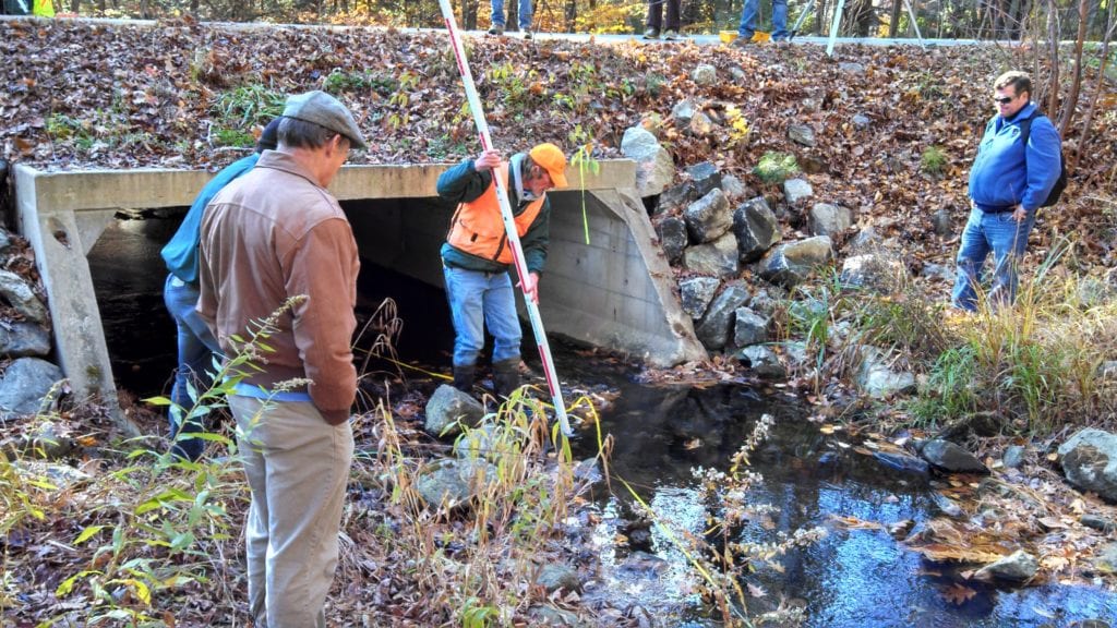
Stream Smart Field Assessment Process
All Stream Smart designs start with a field assessment of the construction site. The following measurements should be taken:
- Longitudinal profile to determine elevation of stream features and slope
- Cross sections to determine channel width and stream form
- Substrate assessment, including key pieces and pebble counts
Watch the field assessment video to learn how these field measurements are taken:
Field assessment resources
- Use Stream Barrier Removal Monitoring Guide (pages 77-81) to record your field data, specifically the following:
- Use the Stream Smart Reference Reach Survey to enter your field measurements. This includes cross section analysis and longitudinal profile to develop a preliminary Stream Smart design.
- Stream Channel Reference Sites: An Illustrated Guide to Field Technique provides technical instruction on establishing permanent references sites for gathering data about a stream.
- The Maine Stream Smart Road Crossing Field Workshop Glossary is a helpful resource of commonly-used terms.
Funding
Financial assistance may be available for some Stream Smart road crossing projects. Projects with high conservation value for fish passage, such as Atlantic Salmon, alewife, or Eastern Brook Trout, may be eligible for financial assistance through partnership with a conservation program.
NEW in 2022: Maine DEP is administering $3 million dollars from the Maine Jobs and Recovery Act for a single round of grant funding in 2022 to assist municipalities with stream crossing upgrades and replacements and will begin accepting applications in mid-August. These monies fund competitive grants that match local funding for the upgrade of municipal culverts at stream crossings. The projects awarded provide public infrastructure benefits such as by replacing culverts that are currently failing and at risk of complete washouts, opens or improves fish passage, eliminates undersized and other impassable culverts and reduces some of the worst ongoing erosion impacts to streams, brooks, and lakes. DEP expects to open the grant application period on or around August 18, 2022, with application due in November. To help municipalities and others involved with these projects better understand the grant program and requirements, DEP has developed four pre-recorded videos in partnership with Maine Audubon, Maine DOT, and Army Corps of Engineers. Follow this link for details.
Possible funding sources
- Funding Opportunities for Stream Smart Road Crossings is an overview of grant programs.
- Private landowners, specifically farm & non-industrial forestland private owners, may be eligible for funding through the USDA NRCS Environmental Quality Incentives Program.
- Municipalities may apply for funding from the Water Bond program.
Construction and Monitoring
There are many different types of structures that can be used for Stream Smart road crossings. Each stream location is unique and requires its own solution to best meet the 4 S’s.
The following videos demonstrate different construction techniques:
- Stream Smart Overview
- Concrete Block Abutment Timber Deck Bridge
- Bottomless Concrete Arch
- Bottomless Metal Arch
- Geosynthetic Reinforced Soil – Integrated Bridge System (GRS-IBS)
- Embedded Concrete Box Culvert
Construction tips
- Review the plans on-site with principal people and contractors
- Have materials and equipment on site and ready before breaking ground
- Stick to the plan, but remain flexible
Monitoring
Visit your site after construction, especially after high flows, to confirm the crossing is working as intended — and to admire your work making real, on-the-ground changes that create longer-lasting roads and support fish and wildlife conservation! In some cases (when funders require it), additional monitoring of stream channel changes provides vital information that demonstrates how successful Stream Smart crossings can be in reconnecting our streams and restoring habitat.