Maine Audubon is part of a massive international effort to track animal movements through automated radio telemetry, a project called the Motus Wildlife Tracking Network. It’s already teaching us new things about how birds and other animals are moving through Maine.
About | Programs | Resources | Data
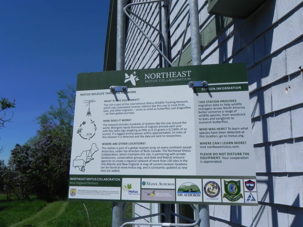
About: Motus, from the Latin for “movement,” seeks to track species migration via a collaborative network of antenna towers which pick up the “pings” of animals fitted with special transponders. The more antennas in the network, the better chance they’ll have of picking up a ping, and the more information available to scientists.
Maine Audubon is excited to be a partner in the Northeast Motus Collaboration that is siting and installing 50 Motus receiving stations across New England, complementing the 45 stations recently installed in the Mid-Atlantic region. Maine Audubon’s two Motus towers are installed on buildings at Fields Pond Audubon Center in Holden and Hamilton Audubon Sanctuary in West Bath. They look like old-fashioned TV antennas, are connected to electricity and the Internet on site, and rise about 35 feet high (other towers are free-standing and solar powered). Each has four antennae that point in different directions, designed to capture movement from various directions.
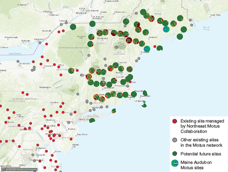
In addition to the two at Maine Audubon sanctuaries, we are partnering with the Western Foothills Land Trust, Bates College, Downeast Lakes Land Trust, Hirundo Wildlife Refuge, Bud Leavitt Wildlife Management Area, and Saddleback Mountain to erect towers on their properties. Up to 14 towers will be installed in Maine, with more sites to be identified and secured in 2022. A map of current receiver locations can be found at motus.org; it gets updated as new sites are added. FMI: northeastmotus.com.
Programs
None scheduled at this time.
Resources
Watch this recording of a presentation by Maine Audubon Director of Conservation Sally Stockwell, Amber Roth, Assistant Professor of Forest Wildlife Management, UMaine, and Fields Pond Audubon Center Manager David Lamon (Jan. 23, 2022).
Data
The Motus network allows researchers to collect data as animals migrate both locally and internationally. This map shows the current sites in the northeast including the two Maine Audubon sites.

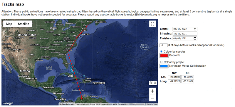
Researchers can track specific projects, data from specific stations, specific species, and even specific individuals. This tracking map (below) shows a Bobolink, tagged at Fields Pond Audubon Center, that migrated to Venezuela.

The Northeast Motus Collaboration was formed in 2017, and receives funding from the U.S. Fish and Wildlife Service’s Competitive State Wildlife Grants program. Other members of the New England Motus Project include New Hampshire Audubon, Massachusetts Audubon, the Willistown (PA) Conservation Trust, and the Carnegie Museum of Natural History. The New Hampshire Fish and Game Department is the lead agency and the Maine, Massachusetts, and Pennsylvania wildlife agencies are partners. Matching funds for the towers, a requirement of the grant, are coming from the Maine Outdoor Heritage Fund (Fields Pond) and a gift in honor of Claire Wilson DePalma (Hamilton) to advance science and education through this state, regional, and global initiative to track migratory birds, bats, and insects.
